Power Still Out for Thousands; Severe Storms Target the East Coast This Weekend

Severe storms have been following the same path this week, trekking from the Midwest into the Northeast. Another round of intense storms rolled through these areas on Thursday, with an EF-2 tornado in Detroit. Thursday's tornado was the first tornado within the Detroit Metro since July 1997!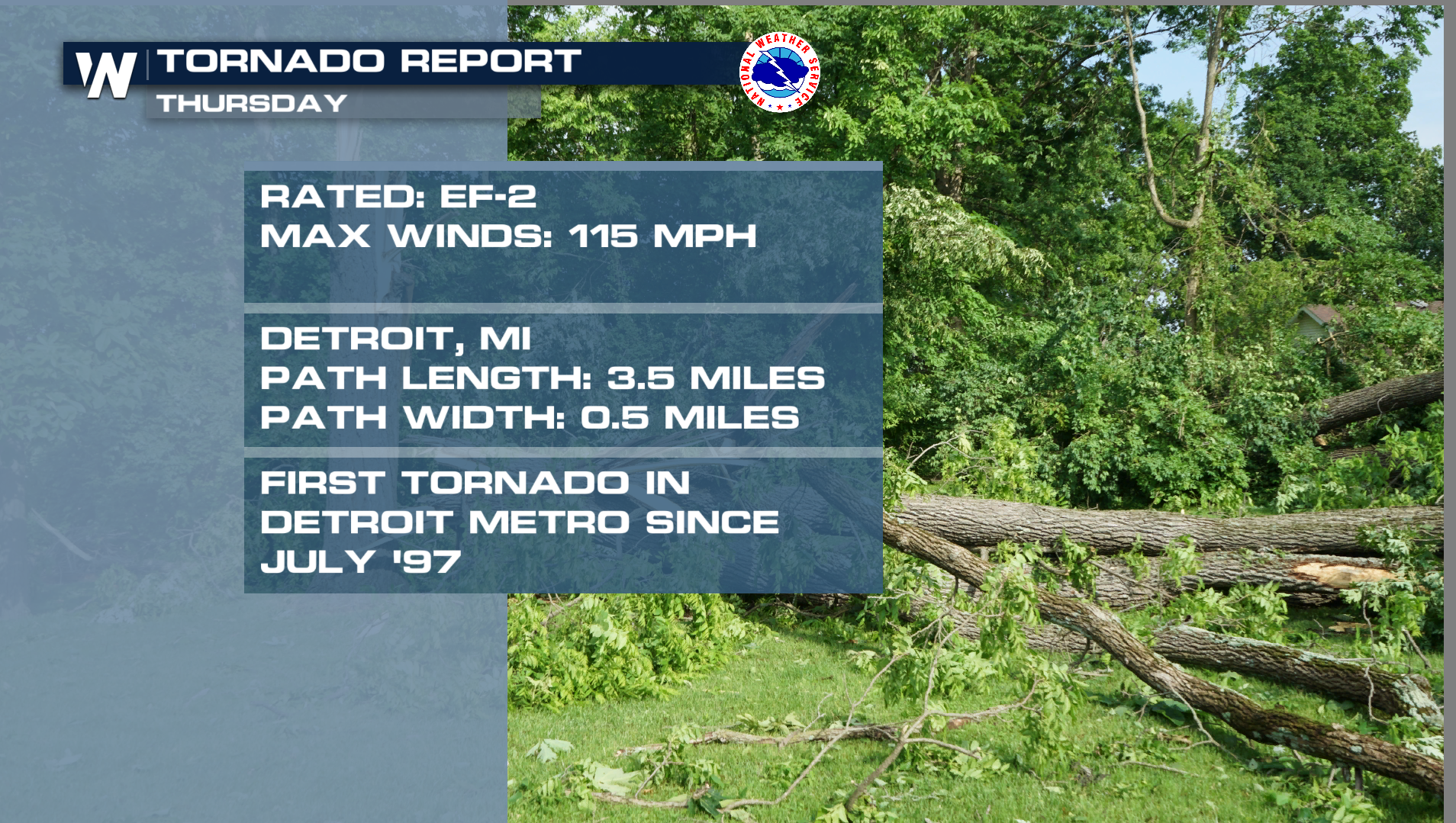
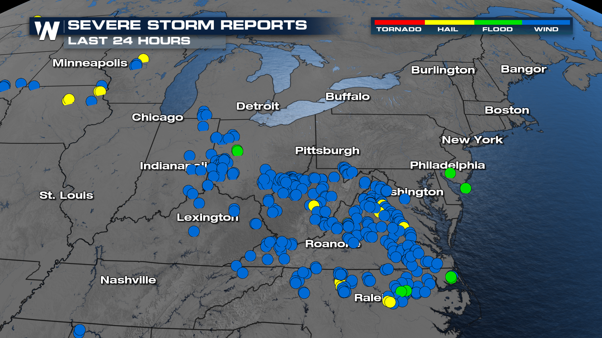 The intense winds have led to numerous downed power lines, leaving around 500,000 households in the dark Friday morning. Those numbers have been steadily improving since, but many are still without power around Detroit.
Severe Threat Shifts South
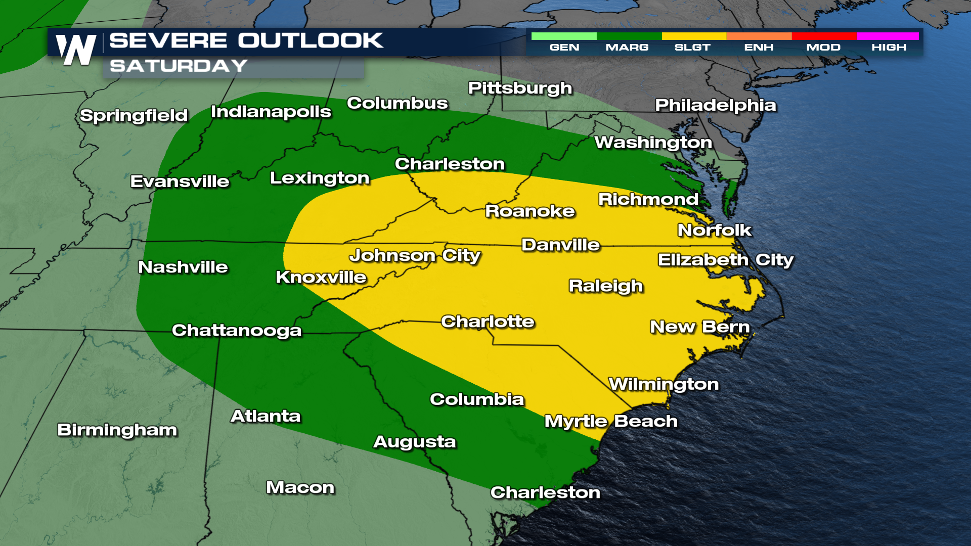
Through Saturday, the overall pattern should begin to change, although a lingering threat for strong or severe thunderstorms may remain across parts of the Carolinas. With repeated rounds of thunderstorms possible, some communities could experience more than one episode of severe weather or flooding before conditions finally improve.
Storm Timing
Saturday
New rounds of storms could get going early Saturday around the Great Lakes, dropping across the Ohio Valley through the day. Storms continue to dive farther south on Saturday as the front cruises down the east coast.
Sun - Mon
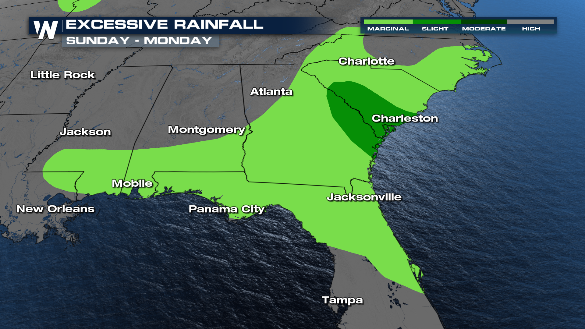
While some overnight storms are possible, Sunday morning looks to start mostly quiet, with a few isolated storms. By the afternoon, the front will trigger a new round of scattered to numerous thunderstorms, with several of these storms turning severe. Monday's threat will follow the front south into portions of Florida, Southern Georgia, and Southern Alabama.
Flood Risk
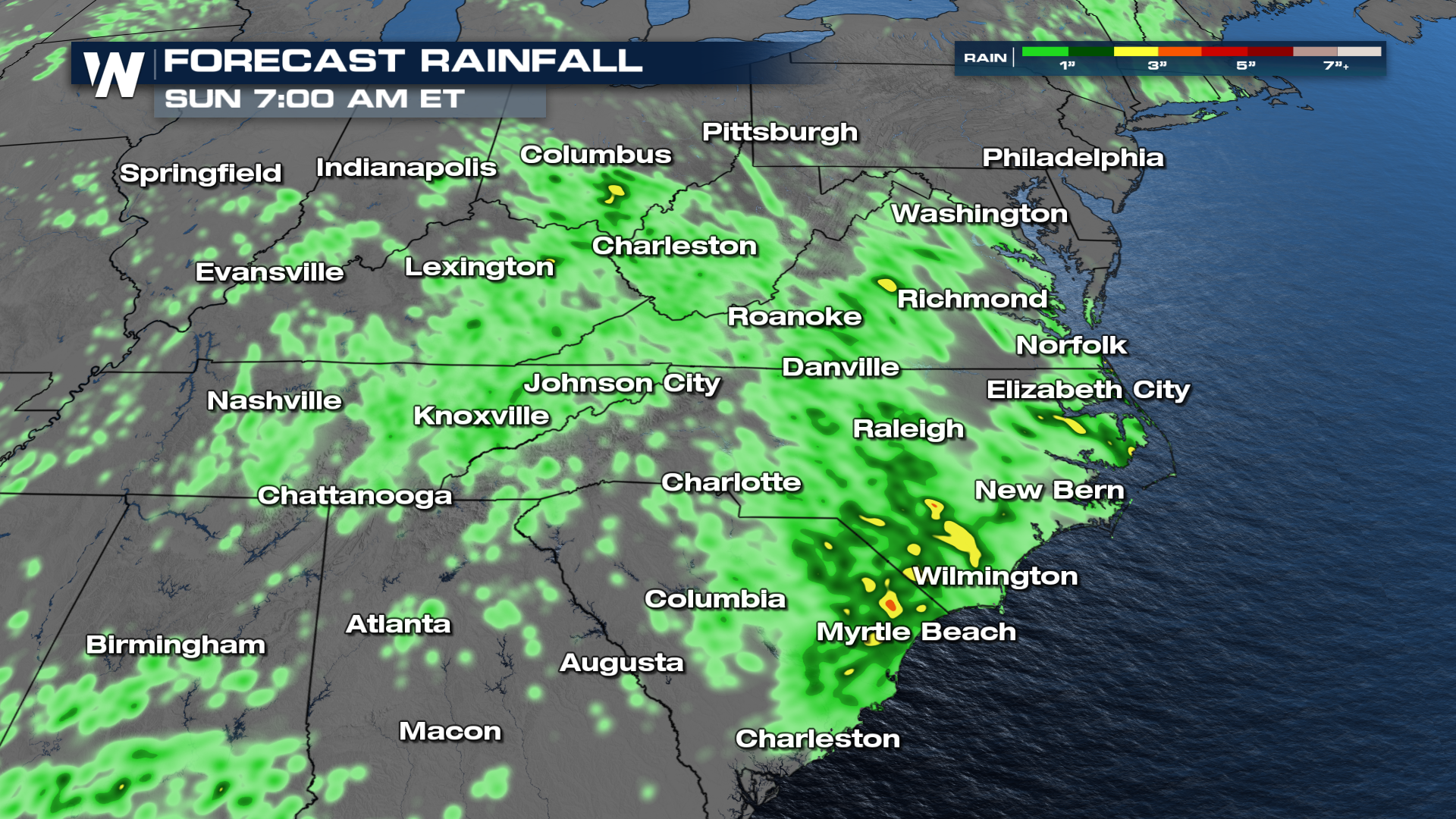
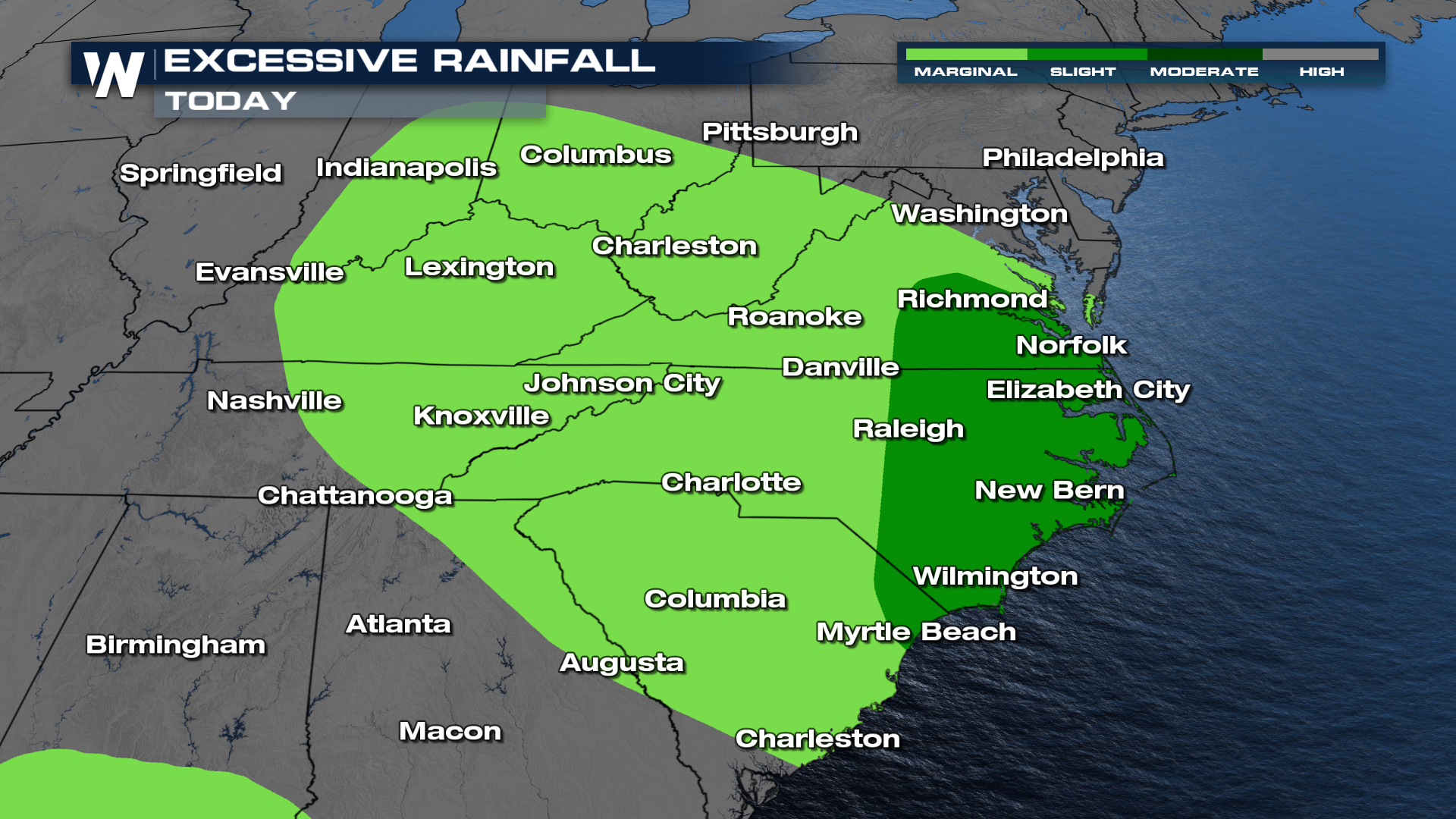
Heavy rainfall rates are expected to lead to flooding issues. The heaviest rain through Sunday morning is likely in the eastern Carolinas and SE Virginia. A level 2 out of 4 risk for excessive rain has been issued for these areas.
For more on the severe and flooding threat across the Northeast, tune in to WeatherNation :10 past the hour for your Eastern Regional Forecast.


